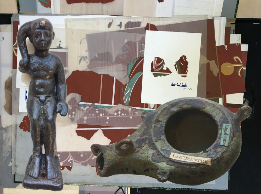
Within the framework of the PCR on Villards d’Héria, one of the objectives is to take all the furniture from the various excavations as the older discoveries to refine the periods of occupation according to the places and the levels in which the objects were found.
A first grouping and sorting operation was carried out under the responsibility of Sylvie JURIETTI, head of archaeological collection at the Musée de Lons and researcher associated with the CNRS, UMR 6298, ARTEHIS, Dijon.
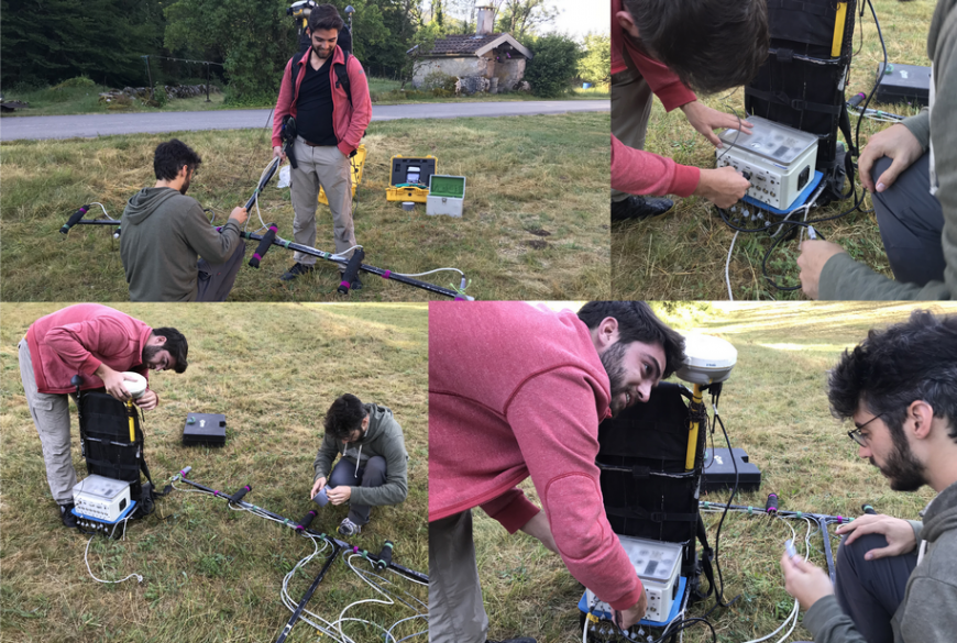
Magnetometric measurements – July 2019
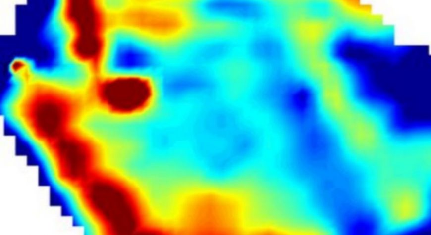
With the authorization of land owners, individuals or the municipality of VILLARDS D’HERIA, we have carried out magnetometric measurements, with the IPGS (Physical Institute of the Globe of Strasbourg) and the collaboration of Bruno GAVAZZI (researcher at the ‘UNISTRA) and Hugo REILLER Engineer graduated from OEST).
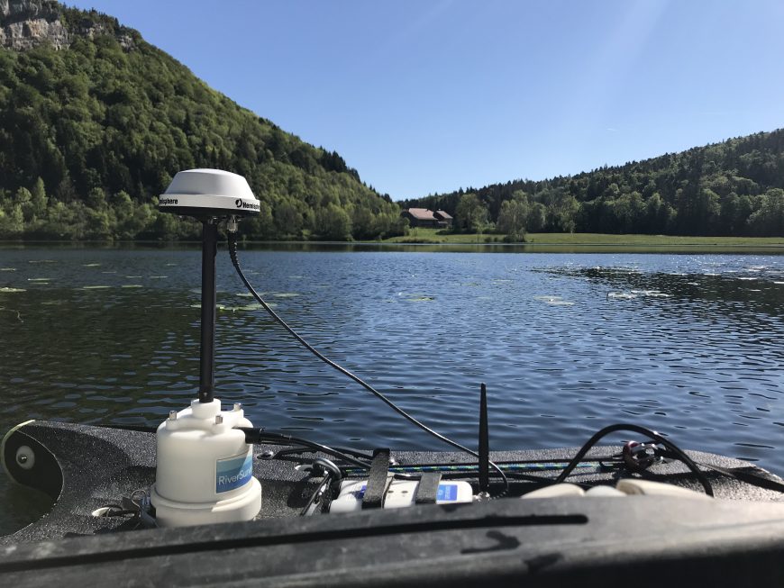
Fine bathymetry – may 2019
Fine bathymetry measurements have been made with new equipment which makes it possible to make a depth measurement in 5 points at the same time, every second
Bouverans Lake / Onnoarcheo

Villards d’Héria – Two water sanctuaries
The commune of Villards d´Héria has the particularity of presenting two cultic assemblies of the Roman period distant by a bird’s eye of one kilometer, connected by a circulation of underground water necessary for the functioning of the lower site. Villards d´Héria is located in the Jura department about 40 km from Lons-le-Saunier, about 20 km from Saint-Claude and 3 km from Moirans-en-Montagne.
The site has two sanctuaries. The first, the best documented, is the so-called “lower site” which was the subject of excavations until 1982 by Lucien LERAT. A 1998 publication, edited by Hélène WALTER, takes up and consolidates all the knowledge, to date, on this site. The second site is located on the banks of Lac d’Antre. It is described for the first time by DUNOD from 1698. Very little archaeological research has been carried out on the upper site. The ancient bibliography is currently the most important source of information.
The authors agree to integrate the sanctuary in the Séquane territory, which also shows the map of LONGNON with the limits of the “pagus Scodingorum”, with the reserve close to the limits of the Land of Saint-Claude and its attachment to the diocese from Lyon .
The waters of Lac d’Antre come mainly from resurgences and underground circulation from the “Grande Maison” or the “Borne Sonnante” to be collected in the lake basin. The water of the lake disappears in the limestone rocks by the loss of the lake which feeds the “Roman well” (natural resurgence) located north of the sanctuary of the Pont des Arches. The stream of Héria is created and is initially fed by the “Black Well” and the “White Well”. According to William VAN ANDRINGA, water is the natural element that unites the two sites, which would explain “the establishment of two physically separate sanctuaries, installed at each end of the water course”.
This observation joins the etymology proposed by Xavier DELAMARRE of the term “antrum”, “antros”, “antrum” which would be “the land between the waters”, or the name of the island, in Old Celtic and Indo-European.
This agglomeration-sanctuary, located at altitude, away from major traffic axes, is distinguished in particular by the originality of its location in a mountainous and wooded context where water is omnipresent. It should be linked to the probable port village of Jeurre, located 6 km south at the confluence of Bienne and Héria, a strategic position which must have favored the transport of heavy materials from the Rhône valley to the site of Villards of Héria.
The sanctuary was probably one of the most important in the Séquane city; it had a regional and even interregional influence as evidenced by the dedication (CIL, XIII, n ° 5353): “To Cnaeus Licinius Campanus, son of Latinus, of the Pomptina tribe, Eduen, priest of the three Provinces of Gaul, gratified by all the charges and honors of his country, the Séquanes at the expense of the State ”.
The acculturation between the Roman and Gallic civilizations is once again evident, as indicated by the Gallo-Roman character of the monumental complex.
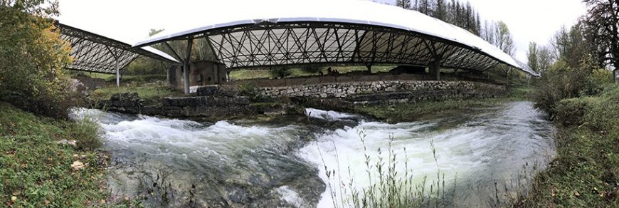
The lower site is the place of worship located on the banks of the stream of Héria at an altitude of 710 m. He’s the best known. However, only part of it has been explored. It is made up of two distinct groups: the cult area itself and annex buildings, traditionally known as hospitalia. The 110 m long religious complex is divided into three parts. To the north is the cult space centered on the Roman well, a basin for the resurgence of the waters of Lake Antre. To the west of the basin is the Pont des Arches, formed by two arches spanning the stream of Héria and supporting a temple. This temple opened then by a staircase, in the east, on a paved place in the center of which was the Roman well. This basin constitutes the central point of the sanctuary, the “natural residence of the divinity”. To the east of this basin, a monumental staircase gave access to a platform on which many fragments of bases and other votive altars were found. One of these bases bears, among other things, a dedication to Mars, a god venerated on the two sanctuaries of Villards of Héria. The whole of this cult space was surrounded by three galleries, one in the North, the other in the South and the last in the West intended for circulation and allowing to articulate the three spaces of the sanctuary: the temple, the place and space for altars.
To the south of the cult space is a trapezoidal square demarcated to the northeast, east and south by circulation galleries. The center of this square is occupied by a circular construction of 7 m outside diameter in large device. The identification of this building is problematic.
However, no trace of hydraulic mortar was discovered. Van Andringa gives a function to such a space: “We think then of the distinction established by Pliny, with regard to the sanctuary of Ceres installed on his lands, between the temple, domain of the goddess, and the reserved portico, specifies- it, for the use of men. In the valley of Héria, the trapezoidal portico, adjoining the temple and the basin, was also reserved for visitors to the sanctuary who could then join the temple of the divinity or frequent the seaside fed by the source.
The bathing area occupies the third part of the Pont des Arches cult area. This building is divided into two non-communicating parts, each with a room with swimming pool, a room on hypocaust with its heating room and a number of other unidentified rooms. The entire complex is surrounded by two galleries, east and west of 70 m in length. A smaller gallery (24 m wide) fences the space to the south. This set does not constitute a thermal space.
In addition to the cult space excavated largely by Lucien LERAT, other buildings have been unearthed on the right bank of the Héria, at a place called “Champs des Tras”. Two states of construction were brought to light by ODOUZE from 1969 to 1972. According to him, the first state dates from the 1st century AD. J-C, these would be modest constructions with a base of stones and wooden partitions that would have burned down. DUNOD also indicates other buildings on the lower site such as “the Palace of the City Governor”, an oval amphitheater and covered market halls. To date, these buildings have not been identified.
1.2. The upper site
The upper site is located at an altitude of 806 m on the northeast banks of Lac d’Antre. It has vestiges which have been described since the end of the 17th century. Some were revealed during the construction of the lake farm around 1679 by Sieur Rosset de Saint-Claude on the site of the great temple. It is rectangular, the cella would measure 18 x 19 m and had “four seats of large appliance”. Two inscriptions were discovered in the construction of the farm. One of them is a dedication to Mars Augustus (CIL XIII 5343). The writings of DUNOD, published from 1698, indicate the presence of a second building.
It is another temple, smaller than the previous one and circular in shape. Unlike the Temple of Mars, it was built in a small device. This building delivered only fragments of sculpted statue, and a base of statuette which mentioned, engraved in dotted lines the word “Bellon” corresponding to the name of the goddess Bellone (CIL XIII 5351). We can therefore assume that this circular temple was dedicated to Bellona, wife of Mars. Several other buildings have been identified over the centuries, but we have no certainty regarding their identification. We note the presence of an enclosure which surrounds the two temples that William VAN ANDRINGA identifies with the temenos of a monumental sanctuary dedicated to Mars and Bellona. According to him, it is likely that they were patron gods of the lake, which would explain why they are found in the lower site.
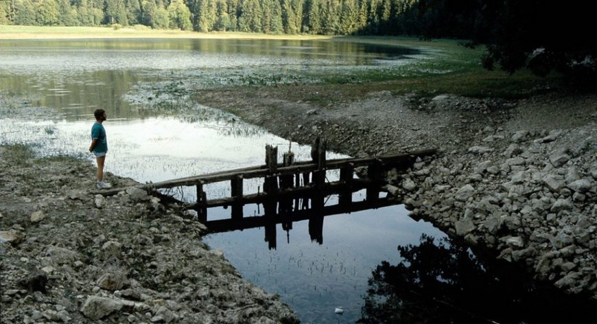
The lake by itself has only been the subject of some research by Pierre PETREQUIN and Jean Louis ODOUZE, who above all indicated the absence of palafittes and the presence of earth dams. It should be noted that the level of the lake was raised by 4 meters compared to its natural level with the successive construction of two dams, the first dating from the end of the XIXth century. On the anthropic origin or not of the lake, Vincent BICHET has shown that it is indeed a natural reservoir.
Lucien LERAT, acheology in Villards d’Héria from 1958 to 1982
Lucien LERAT (1909-1993) studied archeology from 1930 to 1932 at the École normale supérieure in Paris then from 1933 to 1936 as a member of the French School of Athens in Greece. After his return in 1937 he went to the University of Besançon, where he was professor of Greek language and literature until 1955 and from 1955 to 1981 professor of Artistic Archeology (= Classical Archeology). From 1953 to 1960, Lerat was appointed dean of the Faculty of Letters. From 1942 to 1971, he was director of the archaeological sites of Franche-Comté.
Lerat’s research interests were ancient Gaul and Greece. From his dissertation on Western Lokris, which he published in 1952 in two volumes
 Loading...
document http://www.art-chatry.com/
BIBLIOGRAPHY (to be completed with tributes to Lucien LERAT – PUFC 1990)
Locrians of the West. 2 volumes, Paris 1952
Ancient lamps. Catalog of the archaeological collections of Besançon. Paris 1954
Gallo-Roman fibulae. Catalog of the archaeological collections of Besançon. Paris 1956
The Gallo-Roman fibulae of Mandeure. Catalog of the archaeological collections of Montbéliard. Paris 1957
Vesontio. In: Pauly’s Realencyclopadie der classischen Antientwissenschaften (RE). Volume VIII A, 2, Stuttgart 1958, Sp. 1695-1705.
with Yves Jeannin: Luxueil sigilé ceramics. Paris 1960
The “city of Antre”. Myths and realities. Paris 1965
Roman Gaul. Paris 1977. Reprint 1986
The fibulae of Alesia. Dijon / Semur 1979
Dan Besançon Gallo-Roman. Paris 1985
with Hélène Walter: Besançon antique. Paris 1990
The Lac d’Antre wooden dam
The Napoleonic cadastre was established in 1833 for the town of Petit-Villard. It does not present a dam as a construction, however, one notices at the exit of the lake, a relatively straight conduit, towards the overflow, comparable to a form of channel.

(extrait du cadastre napoléonien – AD39 – 3P plan 6317)
For the construction of the wooden dam, the owners agreed to flood their land in 1866.
Before 1868, “Mr. CHAVERIA Placide, PERRIN, BESSON Auguste and VUILLERMOZ all four, having factories on the reach of Héria” were “owners of the dam established at the origin of the outlet of Lac d’Antre. They joined forces to contribute to the costs of setting up the outlet of Lac d’Antre. This deduction is useful to all the machinists of the reach of Héria indiscriminately. They have hoped and still hope that they will meet with them to bear the charges which they have initiated. ”
In December 1868, the dam was described as follows: “The purpose of the dam, established across the lake’s discharge channel, is to retain above the usual level a volume of water two meters in height that the millers , bordering the reach of Héria, can use in times of drought. The structural dam is established at the origin of the outlet of the lake; the threshold is placed flush with the bottom of this stream, that is to say at a level well above the thalweg of the lake; the ridge is flared two meters above the threshold. The water can only flow into the landfill by means of a valve 1.09m wide by 0.55m high. ” “The valve retaining the waters of the lake is constantly lifted in times when the reach of Héria is no longer supplied by sources called black wells and white wells so that the millers can benefit from the flow of water” (1 ).

According to deeds of sale of July 31, 1866 and September 11, 1867, passed before Maître MONNET, notary in Moirans-en-Montagne, the former owners of the lake, gave the right to the factory owners of Villards-d’Héria to establish the dam current whose crest must be 1.30m below the benchmark sheet sealed in the rock and the threshold at 3.30m against the bottom of the same sheet. The factories can thus build up a reserve over a height of 2.00 m, giving them 165.005 m3.

(photo Le Pennec September 1989)
(1) AD39, Sp140, Chapelan Siméon factory in Villards d´Héria, minutes of site visit December 4, 1868
CHIFFLET Pierre François and “Lac d’Antre”
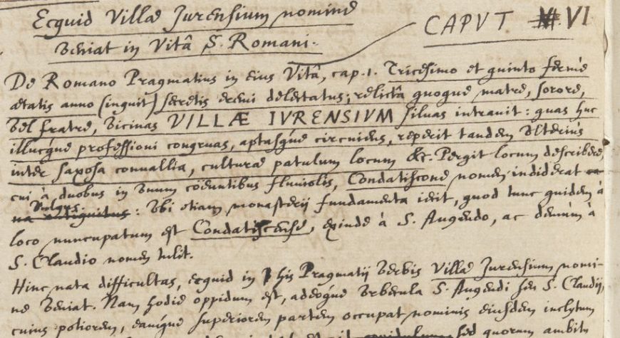
Chifflet describes Lake Antre and its environment around 1640
Continue reading “CHIFFLET Pierre François and “Lac d’Antre””
magnetometry in the “Lac d’Antre”
The data collection was conducted on 27/11/2016 according to the methodology described. The number of recordings made is 5486 points.
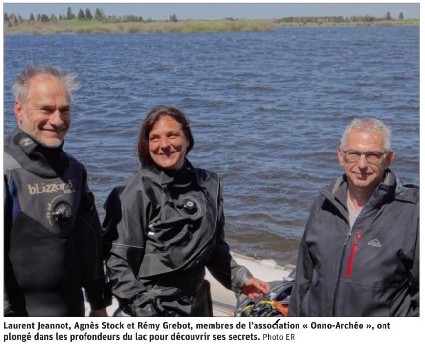
Archaeological dive – regulation
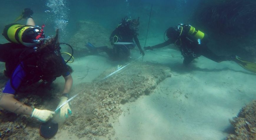
Participation in an underwater archaeological or underwater archaeological site requires having a CAH (Certificate of Ability to Hyperbaria) mention B, for the aeheology.
